 |
|
| torridonbooks.com.au | Information for bushwalkers in Western Australia |
| Home Page | The Books | The Walks | The Gear | ...about ...site map ... contact torridon | |
| Stirling Range | Stirling Ridge Walk | Eastern Access | |||||
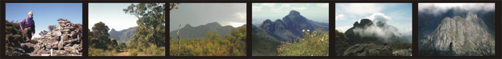
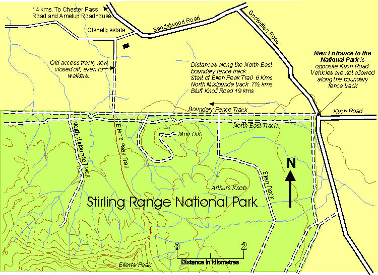
New access to the far eastern end of the National ParkThe old track through Glenelg estate provided easy access to the Eastern end of the National Park from Sandalwood Road. Unfortuneately it passed through private property and has been closed off. The nearest approach for walkers intending to climb Ellen's Peak is now from Gnowellen Road, along the North East Boundary Fence Track. This adds an extra 6 kilometres each way to the ascent of Ellen's Peak. To reach the new access point by road turn off Chester Pass Road at Amelup Roadhouse and drive east along Sandalwood road for 16 kms. Turn south east down Gnowellen Road and the entrance to the national park is a further 2 kms, opposite Kuch Road. Cars are allowed about a hundred metres down the Boundary Fence track then you must proceed on foot. Over the first half kilometre you can expect to encounter slime most foul, but after this the track is clear. To reach the Ellen's Peak trail follow the boundary fence track to the Moir Hill track. Walk about 200 metres up the Moir Hill track and then turn west down the North East track. After about 1 kilometre the track crosses a creek. The start of the Ellen's Peak trail is 80 metres west of this creek. The map below shows further details of the change. | |
 |
Last updated December 2009
© A T Morphet